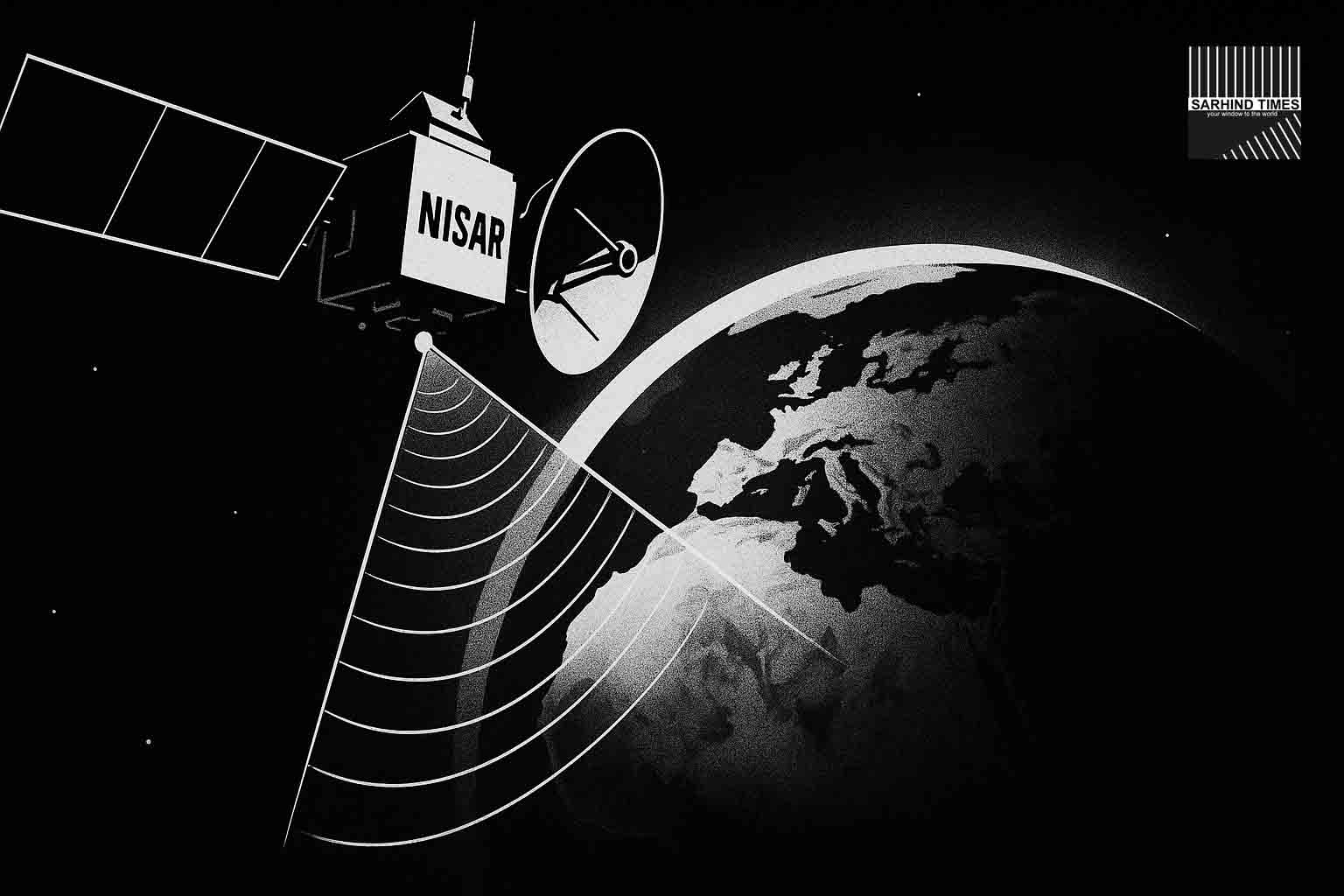
In a landmark milestone for Earth observation and space cooperation, the NASA-ISRO Synthetic Aperture Radar (NISAR) mission has released its first sample L-band radar images from orbit. These preliminary datasets, published after the satellite achieved its target orbit, offer a tantalising preview of the scientific promise that lies ahead. While full science operations are scheduled to begin in November 2025, the early snapshots validate core mission capabilities in imaging Earth’s surface—through clouds, at night, and in all seasons.
This is not merely a technical triumph; it marks a turning point in how India and the United States together will monitor climate change, natural hazards, land use, ecosystems and the dynamic processes that shape the planet. With an open-data policy baked into its design, NISAR’s outputs will feed agriculture, disaster management and environmental policy workflows in the Global South and beyond.
In this deep dive, we examine the mission architecture, significance of the first images, potential applications, challenges ahead, international cooperation, and what to expect as the mission enters its science phase.
1. Mission Overview: What is NISAR?
1.1 Joint vision & background
The NISAR mission is a flagship collaboration between NASA and the Indian Space Research Organisation (ISRO). It is designed as a dual-frequency synthetic aperture radar (SAR) observatory that will systematically map changes in Earth’s land and ice surfaces.
The mission is often described as first-of-its-kind in combining L-band (provided by NASA) and S-band (provided by ISRO) radar instruments for global, repeat observations.
1.2 Technical specifications & orbit
- Launch date: July 30, 2025 (from Satish Dhawan Space Centre, India)
- Launch vehicle: GSLV-F16 – this mission marks the GSLV’s insertion into a Sun-synchronous / polar orbit configuration
- Orbit: Sun-synchronous, approx. 747 km altitude, inclination ~98.5°
- Mission life: Planned for 5 years (with possibility of extension)
- Payload / Instruments:
• L-band SAR (1.25 GHz, ~24 cm wavelength)
• S-band SAR (3.2 GHz, ~12 cm wavelength)
• Polarimetric and interferometric imaging modes - Data resolution and revisit: NISAR aims to detect surface changes on the order of centimeters; systematic global coverage with revisit cycles (~12 days repeat pass)
Because of its dual frequency design, NISAR will be able to probe different layers of the Earth’s surface — e.g., penetrate vegetation, study soil moisture, ice surface changes, vertical displacement and more.
1.3 Why dual-frequency matters
The use of two radar bands gives NISAR enhanced flexibility:
- L-band is more suitable for detecting ground deformation over time, penetrating foliage and less sensitive to small-scale surface roughness.
- S-band, being higher frequency, is more responsive to shorter-scale surface features, vegetation moisture and changes in snow moisture.
- Together, they allow disentangling multiple surface processes (e.g. distinguishing vegetation versus soil change) that a single band alone might misinterpret.
This dual approach positions NISAR as a stronger tool than many existing radar satellites in deciphering dynamic Earth changes.
2. The First Radar Images: What They Reveal
2.1 Release & examples
NASA and ISRO have published the first L-band radar products covering portions of Maine (US northeast coast) and North Dakota farmland / wetlands. These images show land-water boundaries, vegetation patches, wetland features and topographic texture.
These images are preliminary, not calibrated for full scientific use. Still, they validate that the radar payload is functional, geometry is correct, and data capture is viable.
2.2 What the images tell us
- The contrast in radar backscatter clearly demarcates water bodies, wetlands, soil and vegetated land.
- Subtle patterns in the farmland subset suggest NISAR can discern field boundaries, drainage lines, and even moisture gradients.
- Coastal mapping shows the ability to differentiate shoreline outlines and tidal influence zones—even under variable surface conditions.
These are promising signs that the mission is on track. The first imagery acts as a proof of concept for later full-scale monitoring tasks.
2.3 Calibration & validation phase
Between now and November, mission teams (NASA, ISRO and partner institutions) will engage in calibration, validation, geometric correction, radiometric adjustments to align the raw radar captures with ground truth data. Only after thorough processing will the images be deemed “science-grade.”
This phase is critical. Factors like orbital drift, instrument biases, atmospheric interference, baseline estimation, and reference control points all must be tuned.
3. Applications & Scientific Value
Once its science phase is active, NISAR is expected to deliver transformational value across sectors and phenomena. Below are key application domains.
3.1 Natural hazards, land deformation & tectonics
By measuring millimetre-level ground displacements, NISAR can detect:
- Earthquake precursors / aftershocks
- Fault line movement
- Slow land subsidence (urban areas, groundwater withdrawal zones)
- Landslide detection and dynamics
These capabilities are especially crucial in a seismically active region like the Indian subcontinent (Himalayan foothills, Indo-Gangetic plains) and similar terrain globally.
3.2 Cryosphere, ice sheets & glaciers
NISAR can monitor ice sheet mass balance, glacier flow rates, ice shelf collapse, and seasonal snow melt dynamics. These inputs are vital for climate science and sea-level rise forecasts.
3.3 Ecosystems, biomass and carbon cycle
With its penetrating radar capability, NISAR can estimate forest biomass, deforestation / degradation, wetland extents and soil moisture changes. These will feed carbon flux models, land use change studies, and climate mitigation assessments.
3.4 Agriculture, crop monitoring & water management
In monsoon regions and agriculturally dense zones like India, radar time-series data can support:
- Crop stress detection
- Irrigation and moisture anomalies
- Flooding / waterlogging analysis
- Soil moisture dynamics
Radar’s ability to see through clouds makes it especially useful in monsoon months when optical sensors are often hindered.
3.5 Disaster response & resilience
Because radar works day and night and penetrates clouds, NISAR will be a powerful tool for post-disaster mapping (floods, cyclones, landslides) with rapid turnarounds. Governments and disaster agencies can better assess damage, plan relief, and monitor recovery.
4. India’s Gains: From Science to Policy
4.1 Open data access & Indian agencies
One of NISAR’s keystones is open data release — meaning Indian research bodies, disaster management authorities, agricultural agencies, climate institutions, state governments, and startups can use the radar time series freely. This democratizes access to high-end remote sensing.
In India’s context, key uses may include:
- Real-time flood / landslide early warning systems
- Infrastructure monitoring (dams, embankments, bridges)
- Groundwater and aquifer stress mapping
- Forest cover / afforestation tracking
- Coastal erosion monitoring
These capabilities align well with central and state government priorities in climate resilience, agricultural planning, ecosystem conservation and disaster management.
4.2 Enhancing Earth observation ecosystems
The success of NISAR will give a huge boost to the Indian Earth observation industry — encouraging more private and academic institutions to build data tools, analytics platforms, value-added services, AI/ML processing pipelines, map products, alert systems.
It may stimulate growth in the geospatial startup ecosystem, satellite analytics firms, and remote sensing capacity building (training, institutes).
4.3 Diplomatic & strategic dividends
NISAR is another pillar in Indo-US space cooperation (post the 2024 roadmap). It reinforces India’s credentials in high-end space science. It also positions India as a major node for climate & Earth data in the Global South, enabling more global collaboration.
Moreover, having a high resolution, frequent radar view over the Indian region gives strategic benefits — e.g., in border monitoring, topographic change detection, glacial movement along mountain borders.
5. Challenges & Risks
Despite the promise, several technical, operational and programmatic factors will be crucial in making NISAR’s potential real.
5.1 Calibration, drift & stability
Radar systems demand extremely stable calibration. Minute drifts, thermal deformations, orbital perturbations, baseline errors or instrument biases can introduce errors. Ensuring long-term consistency over years is nontrivial.
5.2 Data volume, processing and storage
The continuous radar streams will generate large volumes of data. Efficient pipelines for ingestion, calibration, processing, geocoding, change detection, distribution and archiving are required. The computational infrastructure must scale well.
5.3 Ground truth & validation networks
To validate radar output, ground measurements (GPS, in-situ sensors, reference stations) must be available. For many remote or developing regions, deploying and maintaining such networks is expensive.
5.4 Commissioning delays & mission life
Delays in commissioning, funding, or instrument aging could reduce the effective science period. A shortfall in imaging quality or repeat pass stability would hamper mission goals.
5.5 Interference, noise & artifact correction
Atmospheric disturbances, radio frequency interference, cross-talk, side-lobe artifacts, speckle noise — all these technical challenges need careful algorithmic handling to ensure usable imagery.
6. Roadmap Forward: What to Expect
- November 2025: Full science operations commence, once commissioning and calibrations are done.
- First validated data releases: After calibration and validation, teams will publish science-grade radar time series for public use.
- Regular global coverage: With its orbital pattern, NISAR should revisit regions over time, enabling temporal change detection.
- Partnerships & usage programs: ISRO, NASA and scientific agencies in India will begin joint campaigns in flood zones, glacial regions, forest corridors.
- Value addition: Private / academic institutions will build downstream products — e.g. subsidence maps, hazard alerts, biomass mapping, agricultural indices.
- Mission extension: If the spacecraft remains healthy, the mission could exceed its nominal lifetime and continue producing long-term climate datasets.
7. Why This Matters: Big Picture Impact
- A new era of Earth science: NISAR helps close observational gaps—radar observatories with dual frequencies offer insights that few other satellites can match.
- Actionable data for policy: The bridge between remote sensing and real world decision making (agriculture, disaster response, infrastructure) becomes stronger.
- Resilience in climate stress: With more frequent, consistent data, governments can anticipate, mitigate and adapt to climate extremes.
- Equity in data access: Open data policy ensures that developing countries are not left behind in climate and Earth science innovations.
- Strategic autonomy: For India, having radar views and capabilities opens possibilities in territorial, environmental and glacial domains.
- Global cooperation model: NISAR sets a template for how international space agencies can co-develop mission hardware, operations, data sharing and science.
8. Conclusion
The first images from NISAR are much more than a technical footnote—they are the first step of a journey that could reshape how we monitor and understand our changing planet. In the months ahead, as calibration gives way to science, that journey may yield insights that move the needle on climate change, disaster readiness, environmental management, and sustainable development.
NISAR sits at the intersection of technology, diplomacy and earth science. Its success will depend not just on hardware, but on ground networks, processing pipelines, institutional partnerships, and inclusive access. For India, it is an opportunity to lead in geospatial intelligence, climate solutions, and scientific capacity. For the world, it is a new lens to see how Earth breathes, shifts and responds.
#NISAR #ISRO #NASA #EarthObservation #Climate #RemoteSensing #SpaceTech #EarthScience #RadarImaging #IndianSpace


+ There are no comments
Add yours