
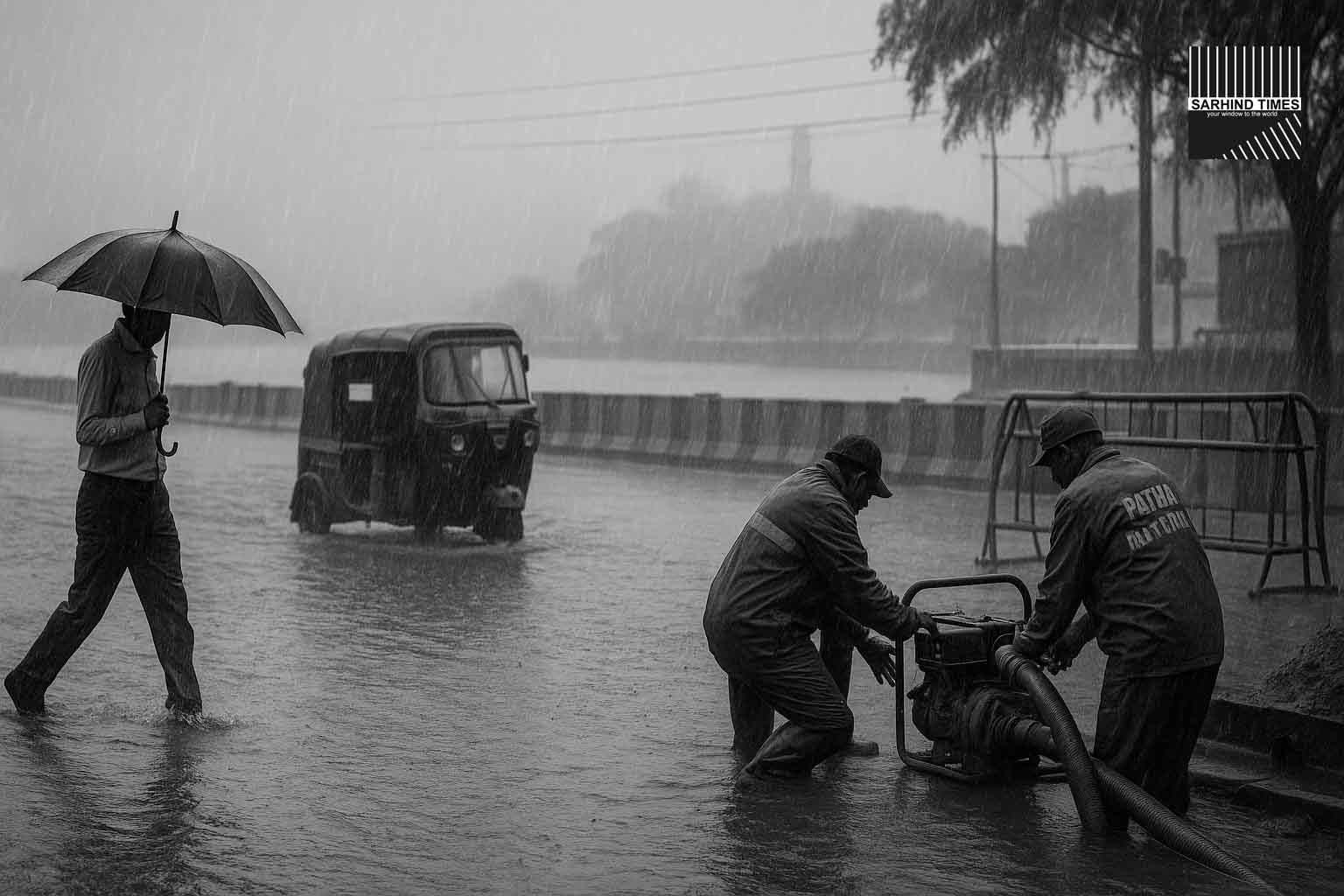
The India Meteorological Department has placed parts of Bihar under an orange alert for heavy rain, urging caution against waterlogging, flash floods and lightning. Officials told district administrations to activate their disaster-response playbooks as showers persist into the weekend.
The quick take
- Alert level: Orange alert (be prepared) for parts of Bihar; widespread thunderstorm/lightning risk across the state.
- Timing: Today into the next 48–72 hours, with rain bands shifting across north and central districts.
- Districts in focus (recent IMD/local bulletins): Patna, Muzaffarpur, Samastipur, Gaya, West/East Champaran, Gopalganj, Siwan, Begusarai, Kishanganj and others flagged for heavy rain at intervals.
- Backdrop: IMD warned yesterday/today of heavy rain over Uttar Pradesh and Bihar as a monsoon/cyclonic circulation sits over east UP–Bihar; DD News echoed continued heavy rain over Bihar.
What the IMD is saying (in plain English)
The current set-up—a monsoon trough and a cyclonic circulation over east UP–Bihar—is feeding moist south-easterlies into the Gangetic plains. Result: intermittent heavy spells, frequent lightning, and localized squalls. IMD’s sub-division warning page for Bihar shows a run of Day-1/Day-2 heavy-rain alerts followed by thunderstorm/lightning through early next week. Translation for city and district officials: stay in readiness, keep pumps, cutters, and quick-reaction teams on call, and issue commuter advisories.
Who’s most at risk—and why
- Urban pockets (Patna, Muzaffarpur, Bhagalpur): Waterlogging at low points and underpasses; feeder outages; slow public transport.
- Rural flood-plains (north Bihar): Short-fuse river rises, culvert overtopping, kutcha-road damage; lightning injuries remain a persistent hazard in monsoon peaks. Kishanganj and adjoining districts have seen torrential spells in recent days, reminding responders how fast conditions can change.
- Agriculture: Moisture recharge is welcome for standing crops, but lodging and flowering-phase damage are possible under very heavy bursts.
District pointers (based on recent alerts & reportage)
- North/northeast arc (Kishanganj, Araria, Purnea, Supaul): Heavier bursts and flood risk flagged in recent IMD notes.
- Central belt (Patna–Samastipur–Muzaffarpur): Orange alert windows and thunderstorm warnings; prepare for traffic disruptions and short power cuts.
- West/East Champaran, Gopalganj, Siwan: Watches for heavy rain; drain-clearance and pump staging advised.
What to do today (reader checklist)
For households & commuters
- Avoid flooded stretches; don’t lift barricades. Park on higher ground.
- Keep phones charged; store helplines (disaster control room, discom, municipal).
- During lightning, shelter indoors; avoid metal rooftops and lone trees.
For shopkeepers & housing societies
- Clear silt from drains, basements and ramps; deploy sandbags where needed.
- Test sump pumps; keep portable gensets above flood line.
- Secure loose signage/canopies; switch off mains if water enters premises.
For farmers
- Delay urea/drenching ahead of heavy bursts; tie up standing paddy; clear field drains; move livestock to raised shelters.
The science in a sentence (or three)
An active monsoon trough plus a cyclonic circulation over east UP–Bihar concentrates moisture and convergence, producing meso-scale rain bands. With saturated soils in pockets, even a few hours of 50–80 mm rain can tip neighborhoods into flash flooding—hence the orange alert (“be prepared”), as opposed to a routine yellow (“watch”).
Recent numbers and trendlines
- IMD Patna coverage this week flagged heavy-rain alerts for multiple north and northeast districts (e.g., Supaul, Purnea, Kishanganj, Araria), with thunderstorms/lightning risk across the state.
- Statewide alerts over the last 48 hours repeatedly mentioned Bihar + east UP under orange for heavy rain; DD News also reported continued heavy rainfall over Bihar.
What officials are doing
District disaster-management teams have been put on readiness; standard SOPs include pre-positioning pumps, sanitizing drain outfalls, keeping NDRF/SDRF detachments on call, and issuing school advisories when peak bands overlap with commute windows. (These actions track typical IMD orange-alert protocols.)
What to watch next (next 72 hours)
- Band timing: Night-time into early-morning bursts often produce the worst waterlogging.
- River gauges: Quick rises on tributaries after upstream rain.
- Lightning density: If storm tops stay cold on satellite loops, expect more lightning advisories.
- IMD updates: Re-check the Bihar sub-division page each morning/evening for upgraded warnings.
Patna outlook at a glance (widget above)
Patna stays cloudy with recurring showers through the next few days; daytime highs ~31–32°C with muggy nights. Use the forecast widget at the top for day-by-day planning. (IMD’s regional bulletins may still upgrade/downgrade alerts based on live radar.)
Why this matters beyond today
Bihar’s monsoon variability has been pronounced this season—with several deficit districts and episodic very heavy bursts—which complicates both flood and drought management. That’s why pre-emptive drainage, lightning safety, and farmer advisories are critical when an orange alert is in force.
#BiharRain #IMDAlert #Monsoon #Weather #DisasterPreparedness #Patna #FloodWatch #Lightning


+ There are no comments
Add yours